I have always loved maps so when I started researching my ancestors I could indulge my love for them even more. I found the following prints at a market in Port Adelaide recently. They were drawn by Thomas Moule in 1830. I hadn’t heard of Moule but looked him up when I got the maps. I’ll need a magnifying glass to be able to read the small print and mark the towns where my ancestors lived.
Thomas Moule (1784 – January 1851) was an English antiquarian, writer on heraldry, and map-maker. He is best known for his popular and highly decorated county maps of England, steel-engraved and first published separately between 1830 and 1832.
Moule was born in Marylebone, London. He sold books in Duke Street, Grosvenor Square, from 1816 to 1822. Later, he became an inspector of ‘blind’ (illegibly addressed) letters at the General Post Office. He died at his residence in St.James’s Palace, to which he was entitled as Chamber-keeper in the Lord Chamberlain’s Department.
http://en.wikipedia.org/wiki/Thomas_Moule
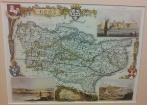
Kent, England
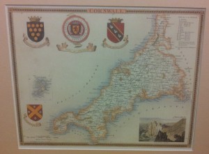
Cornwall, England
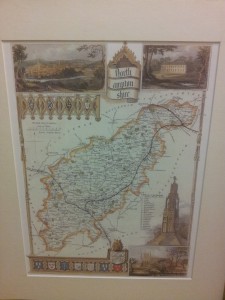
Northamptonshire, England
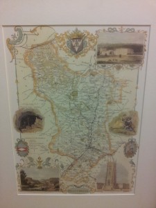
Derbyshire, England
Super shopping, Kylie.